Maps are never neutral. They shape what we see, what we count, and what we govern. A boundary printed on paper authorizes some claims and erases others. A line splitting a mountain range between two states decides which forests get fire crews and which do not. The cartographer’s hand reaches into the world long after the ink dries.
Most of the maps that govern modern life were drawn for taxation, conquest, or extraction. Cadastral surveys parcel the ground for property records. National maps fix borders negotiated at distant tables. Resource atlases classify forests as board feet and rivers as kilowatt-hours. These maps work very well at what they were designed to do. The trouble is that they were not designed to show watersheds, foodsheds, salmon runs, migration corridors, or the places a community already cares about. When the only available map cannot see those things, the institutions that rely on the map cannot see them either.
Bioregional mapping begins from a different premise. It treats the living systems of a place, and the people who inhabit them, as the primary subject of representation. As Brandon Letsinger writes, it is “the art of making people care, and the practice of making visible the layers of a living place.” This page is concerned with why that practice deserves attention now, in 2026, as climate disruption, indigenous resurgence, watershed governance failures, and jurisdictional fragmentation press on every region simultaneously.
Whether in our minds, or printed on paper, maps are powerful talismans that add form to our individual and social reality. They are models of the world for what our senses see through the filters of environment, culture, and experience.
Douglas Aberley, Boundaries of Home (1993)
Why current cartography is not enough
The dominant maps of the present moment are produced by states, by global mapping platforms, and by the proprietary GIS stacks of resource companies and insurers. Each carries the priorities of its commissioner. State-issued maps locate roads, parcels, and taxable improvements. Platform maps locate the gas stations and reviewable destinations that drive advertising revenue. Resource maps locate what can be cut, drilled, dammed, or insured against. None of these are wrong inside their own purpose. All of them omit most of what a community would need to govern its own place.
The omissions have been catalogued for decades. The last stand of old growth in a neighborhood is rarely on a public map. Indigenous territories are routinely absent or rendered as historical artifacts rather than as ongoing political realities. Migration corridors used by elk, salmon, and shorebirds cross dozens of jurisdictions and appear on no single dominant map. Foodsheds, the catchments from which a community is actually fed, are almost never mapped at all. As Letsinger puts it, “if these things are not on a map, policymakers, developers, companies, planners, and governments effectively do not see them.”
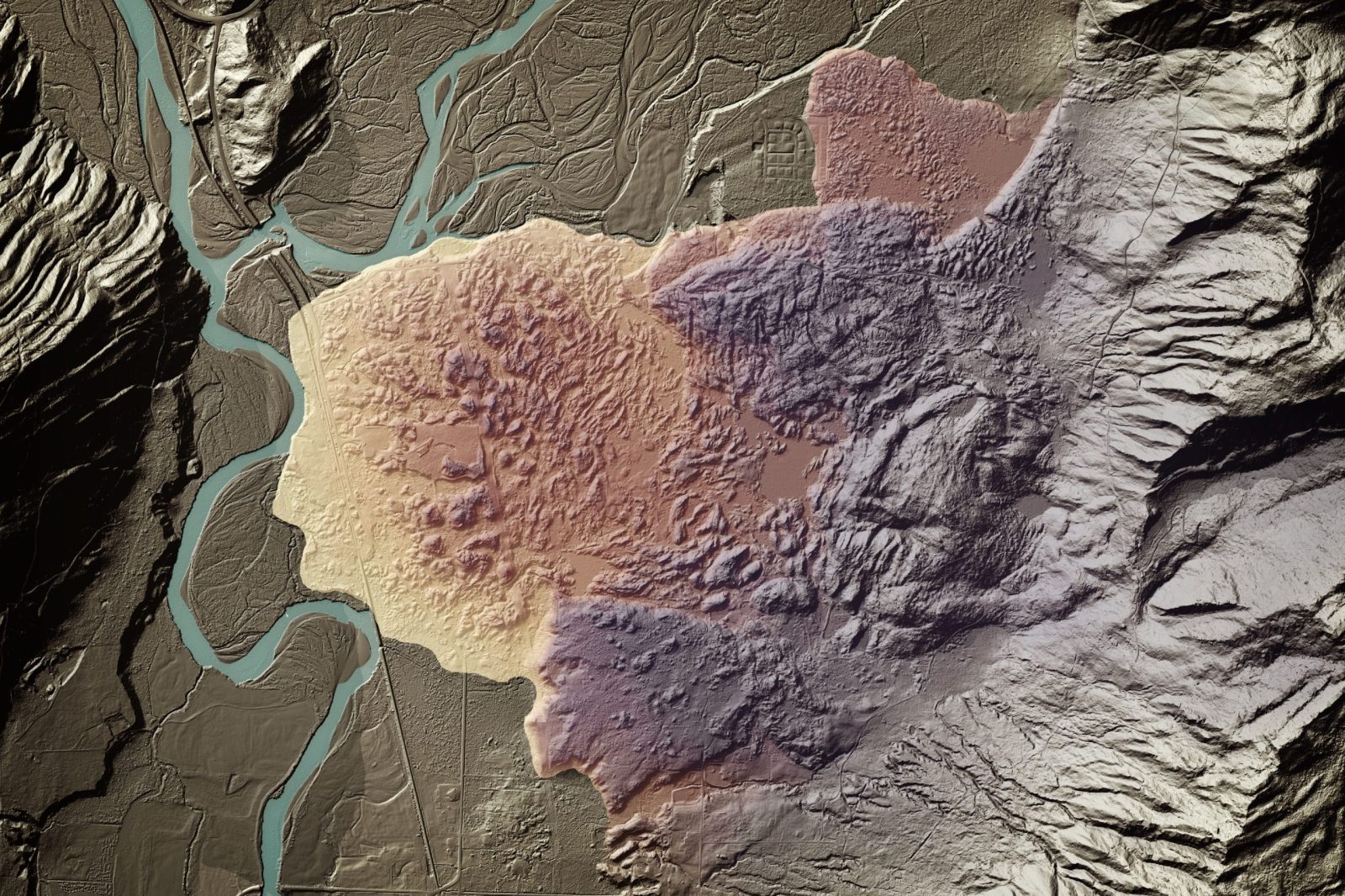
The problem deepens when straight lines are imposed on living landscapes. David McCloskey, in On Bioregional Boundaries, describes climbing in the Pasayten wilderness and finding a narrow, cleared swath running straight up and down 8,000-foot peaks to mark the 49th parallel. The winds, the trees, the salmon, and the native peoples, he notes, do not acknowledge such arbitrary lines as significant. The line exists only to enforce the map.
What mapping makes possible that nothing else does
A bioregional map produces something no other instrument produces: a shared spatial vocabulary for a region, made by the people who live in it, that a community can use to recognize itself as a community. Each phrase matters. Shared, because the map is built collectively rather than handed down. Vocabulary, because the map names features and relationships that did not have public names before. Made by the people who live in it, because no outside surveyor can substitute for a resident’s knowledge of where the deer cross in winter, where the storm drains overflow, where the elders gather plants.
From that shared picture, several things become possible that were not possible before:
- Governance grounded in actual systems. A watershed council can convene around a real watershed rather than around the political subdivisions that happen to overlap it. A regional food policy can be written for a real foodshed.
- Restoration that follows function. Replanting a riparian corridor, removing barriers from a salmon stream, or reconnecting a fragmented forest requires knowing where the corridor, the stream, and the forest actually are, in their full extent, regardless of who owns what parcel.
- Finance that flows to place. Bioregional finance vehicles and regenerative investment funds need a spatial referent. They cannot deploy capital responsibly into a region they cannot describe.
- Education that begins where students live. A child who has helped map their watershed will not need to be persuaded later that the watershed exists.
- Defense of place. When a pipeline, a clearcut, or a data center is proposed, a community that has already mapped its own values, sacred places, water sources, and ecological infrastructure can answer in its own terms rather than in the terms of the proponent’s environmental impact statement.
None of this is theoretical. The Tsleil-Waututh First Nation produced a forty-sheet bioregional atlas of their 720-square-mile traditional territory and used it to ground treaty negotiation and community planning. The Tsilhqot’in Nation v. British Columbia case turned in part on maps documenting traditional territories; cartography the dominant maps did not contain became, in court, an instrument of sovereignty. The Salish Sea Community Atlas drew approximately 3,000 participants across 17 islands into a coordinated mapping effort that gave island communities a shared reference for protecting what they valued.
The map locates accurately on land those places we value. Look at the power of political boundaries that are visible only on a map; they can lead to wars. How much better to use a map for peace.
Briony Penn, Islands in the Salish Sea: A Community Atlas (2005)
The political work of redrawing the lines
Every map is a proposal about what counts. Redrawing the lines, even on paper, makes new things possible. The history of bioregional mapping is in significant part a history of communities discovering that the act of producing a map shifted the political terrain.
Examples are global. Salmon Nation, articulated as a region defined by the historic and current range of Pacific salmon, gives a different shape to the Pacific Northwest than its national borders suggest. The Hudson Valley has been mapped repeatedly by groups working on watershed restoration, food systems, and indigenous land return, each map shifting what governance and philanthropy can address. The Sacred Headwaters of northwest British Columbia, where the Stikine, Skeena, and Nass rivers all rise in a single high basin, became a focal point of indigenous-led resistance in part because the headwaters could be mapped as a coherent place. The Cascadia map, refined by David McCloskey across three decades and featured on the cover of the 2015 Esri Map Book, illustrates a region whose ecological integrity stretches from southeast Alaska through northern California. In the Great Lakes, the Mississippi, the Río Grande, the Klamath, and the Sonoran Desert, in Aotearoa, Catalonia, the Andes, and the Mekong, similar work is underway. None of these regions reads naturally on a national map. All of them are real.
Indigenous mapping traditions, which long predate Western cartography and continue to evolve, have been central to this redrawing. Maps had been used for centuries to erase indigenous presence and authorize occupation. The reclamation of mapping has been a deliberate counterstrategy: combining oral history, ancestral knowledge, ceremonial geography, and contemporary GIS to reassert territorial reality. Linda Tuhiwai Smith’s analysis of cartography as a tool of colonization, and Audra Simpson’s framing of refusal as a political stance, both bear directly on this work. To map on one’s own terms is to refuse the cartographic terms of the colonizer.
The precondition for bioregional governance
You cannot govern a watershed you have not mapped. You cannot defend a forest your community does not know. You cannot align a regional economy with ecological reality if no shared picture of that reality exists. These are not slogans. They describe how governance, in the practical sense, fails or succeeds.
Watershed governance, where it works, rests on a map of the watershed that participants accept. Where competing maps are in use, governance stalls. A municipal stormwater plan that ends at the city limit cannot manage a watershed that does not. A county comprehensive plan that does not show the foodshed cannot reason about regional food security. A state wildlife corridor program that respects state lines cannot keep faith with elk that do not. The bioregional response is not to abolish existing jurisdictions. It is to add a layer of representation, the bioregional layer, on which jurisdictions can coordinate.
Once the bioregional map atlas is completed it becomes the common foundation of knowledge from which planning scenarios can be prepared, and decisions ultimately made. The community learns about itself in the process of making decisions about its future.
Douglas Aberley and Chief Michael George, Tsleil-Waututh Nation Treaty Office (1998)
“The community learns about itself” is the phrase that does the most work there. Mapping is not only an output; it is a process of collective learning. Participants come away with a different understanding of where they live, who they live with, and what their place needs. That learning is the precondition for any durable bioregional governance, whether it takes the form of a watershed council, a foodshed cooperative, an indigenous-led co-management agreement, or a Department of Bioregion branch.
Mapping in 2026
The case for bioregional mapping has been made for fifty years. The case for bioregional mapping now rests on a set of conditions that are sharper than they have ever been.
Climate disruption is rewriting the physical layers of every region in real time. Snowpacks are shifting elevation, fire seasons are lengthening, coastlines are moving, species ranges are migrating poleward and upslope. Bioregional mapping, because it treats the map as a living document that changes and evolves, is structurally suited to this condition in a way that static state cartography is not.
Indigenous resurgence is also a defining feature of the present period. Land back, co-management agreements, and the legal recognition of traditional territories are reshaping governance across many regions, and each of these moves rests on, or produces, mapping. Communities that have lived through wildfire, drought, or housing displacement are learning that the institutions designed to respond to these events were designed against the wrong map.
An invitation, not a specialty
Mapping is not a technical specialty. It is a civic practice that anyone can begin. Peter Berg framed the entry point as three questions: Who am I? Where am I? What am I going to do about it? Those questions are answered, in part, on a map.
You do not need a degree in geography. You do not need a GIS license. You need curiosity, a willingness to look closely, and a growing love for the particular place where you live. From that, in time, comes the map. From the map comes the conversation. From the conversation comes the possibility of governance, restoration, and care that the existing maps cannot support.
Sibling pages in this section describe the methodology for mapping a bioregion, the indigenous mapping traditions that anchor the field, and the workshop format through which a local team can begin. Each is its own subject. The argument here is the prior one: that this work matters, that it is the precondition for everything else bioregionalism proposes, and that an invitation to take it up is an invitation worth accepting.
Bioregionalism is about bringing that which has been separated back together. We do not surrender affiliations to other causes; we simply share an understanding that our actions bear most fruit when interrelated in an ecologically and culturally defined place.
Douglas Aberley